

























































An open-source cave-mapping project has evolved from a basic electronic surveying tool into a Raspberry Pi-based system capable of producing textured 3D models of underground environments.
Phil Underwood has developed several generations of open-source hardware for cave surveying, progressing from basic electronic measurements to a system capable of capturing data for textured 3D cave models. The project aims to make underground surveying faster while keeping the equipment practical to build and modify.
Traditional cave surveying uses a compass, inclinometer and tape measure, with measurements recorded manually before being processed into a three-dimensional map. Underwood’s first electronic surveying device, developed in 2008, automated part of this process using a PIC18LF2550 microcontroller, dot-matrix display, accelerometer and magnetometer. The sensors provided heading and orientation, while distance was still measured separately.
A major hardware update in 2020 replaced the earlier controller with a 32-bit microcontroller and added a 3D-printed frame and laser rangefinder. The additional processing capability reduced some manual work, although the laser measurements were not always reliable. By 2023, the system had gained an integrated 3D-printed enclosure, custom silicone buttons and a revised user interface, while its firmware was moved to CircuitPython to make it easier to understand and modify.
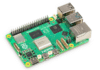
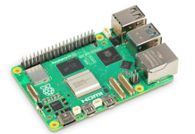
The latest version adds a Raspberry Pi 5 Compute Module and two low-light cameras for photogrammetry. Camera data can be combined with heading and orientation measurements to produce a textured 3D representation of the cave, reducing manual modelling. However, the cameras introduce durability concerns in environments exposed to water, mud and impacts, while the Raspberry Pi consumes more power than the microcontrollers used in earlier versions.